My longstanding desire to visit Tawang was fulfilled a few years back when we decided to join a group of tourists visiting Arunachal.
After a night’s journey from Howrah, the tour company took charge as we detrained at Guwahati. Cars were allotted and our luggage was taken care of. We drove to our hotel thinking of what lay ahead.
Our first destination after an early lunch was the famous Kamakhya Temple on the outskirts of Guwahati. It is famous all over India as a great Centre of tantric ways of worshipping the mother goddess. Legend has it that when Sati, the consort of Lord Shiva, fasted to death at her father’s house, a deeply saddened Shiva took her body on his shoulder and started running across the universe in a fit of rage. As other gods could not dissuade Shiva from this, which was going to destroy the whole creation, Lord Vishnu used his sharp-edged wheel Sudarshana Chakra to cut Sati’s body into pieces. All the places where the body parts fell, became centres of Shakti (the feminine, divine creative power or Devi) worship or Peetha. Kamakhya is one such holy place.

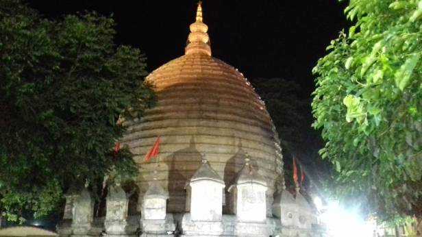
From the outside, the temple at Kamakhya is like any other Hindu temple built in the Assamese style. However, the sanctum sanctorum – where the sacred body part (fossilised into a piece of stone) is kept and worshipped – is in a natural cave which goes down several feet below the surface. To reach this dark Garva Griha, lighted by only two brass oil lamps, we had to remain in a line for nearly four hours. Fortunately, we did not have to stand all through, as there were chairs for all to sit and move slowly ahead. The last hundred metres or so had to be walked.
I do not know what I saw in the extremely dim light of the brass lamps, but it was quite an experience. Of course, the devotees’ faces were bright and satisfied when they finally came out of the cave!
Tawang, our last destination, was about 500 km from Guwahati, the capital city of Assam and gateway to the northeast. But because of the nature of the terrain, we were to cover this distance in three days, with two halts at Bhalukpong and Dirang. It would be a long journey the next day. So, we retired after an early dinner.
After breakfast the next morning, we started for Bhalukpong. On the way, we visited the Balaji Temple and the Vashistha Ashrama. The former, built on a huge plot of land, is a rather poor replica of the original and it appeared drab and lacklustre to me. The Vashistha Ashrama looked like an ancient place, more interesting and with a charming little stream passing by.
The drive to Bhalukpong was nice. The road was good, passing through the lush green countryside with cute little houses surrounded by the ubiquitous date palm trees swaying in the gentle breeze. We crossed a very beautiful, pillared bridge over the Brahmaputra near Tezpur.

We reached our hotel at Bhalukpong in the late afternoon. Here, security personnel checked our inner-line permits – without which even Indians are not allowed entry into Arunachal Pradesh. We felt that we were in the proximity of the India-China border. The real adventure begins some 20 km from Bhalukpong where the narrow, winding and landslide-prone road starts its upward journey towards the upper reaches of Arunachal Pradesh.
Bhalukpong has little to offer by way of tourist attractions. However, for us from the plains, the pebbled bed of the swift-flowing Buruli river was a good spot to unwind and breathe in some fresh mountain air. With rolling green hills on both sides, the view was pretty. What was not so pretty was the sight of little girls, barely seven or eight years of age, carrying small loads of stones from the river’s bed to where their parents were busy hammering them into chips, perhaps in return for a small wage paid by stone merchants. I do not know if these girls were attending any school, but the probability, quite apparently, was remote. After a little stroll in the small local market, we were back at the hotel.
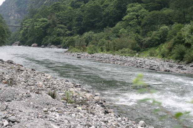
The little stream Buruli
During this journey, early dinner was the norm, and it would invariably be followed by a briefing by the manager about what ordeals awaited us the next day. He painted such horrible pictures of the journey ahead that the actual journey – even though it was tough and in places dangerous – did not scare us anymore. We were tired, the bed was soft and the night quiet. So, we slept like logs till one of the assistants rang the doorbell to wake us up and served the first hot tea of the day. After breakfast, we hit the road.
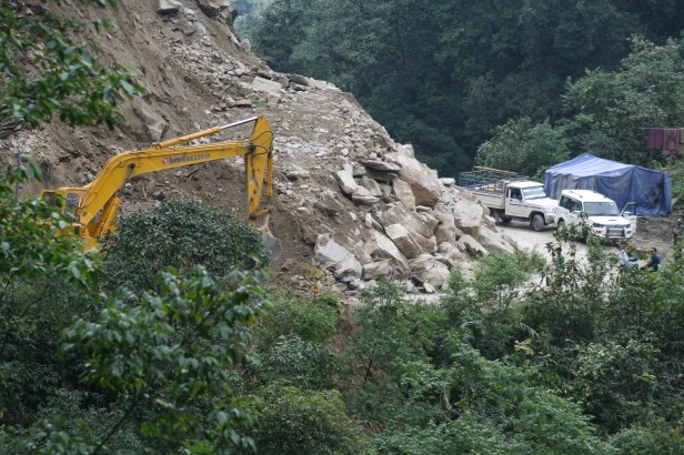
As our car slowed down on the narrow, hilly road and came to a halt behind a long line of other vehicles, we noticed the men and machines at work. A huge earthmover was busy removing the stones and soil that had rolled down the hill and blocked the road. It looked like we would be stuck for quite some time. So, we got off the car to look around. The sky was slate grey, and the valley below was covered in a thick mist that was slowly rising.

The clearance to proceed came at last and our convoy started its tortuous journey uphill once again. The road wound its way upwards, with the mountain slope on one side and a deep gorge, densely forested, on the other. Far below we could see dear little Burli’s rocky course like a strip of sparkling silver. It was beautiful scenery, but the twists and turns of the road and the occasional skidding of the wheels in the mud were scary.
Our driver Shahjahan, however, had a steady hand and a cool head. He drove carefully at a decent pace and steered us safely through the hazardous course. I noticed that several times we drove right to the top of a mountain and came down on the other side, only to climb another, higher one! After crossing several mountains, we stopped for lunch near a small waterfall, and just above a picturesque little rivulet. The place was beautiful and we had some photography by the time the lunch was served.


Lovely Place to halt for lunch
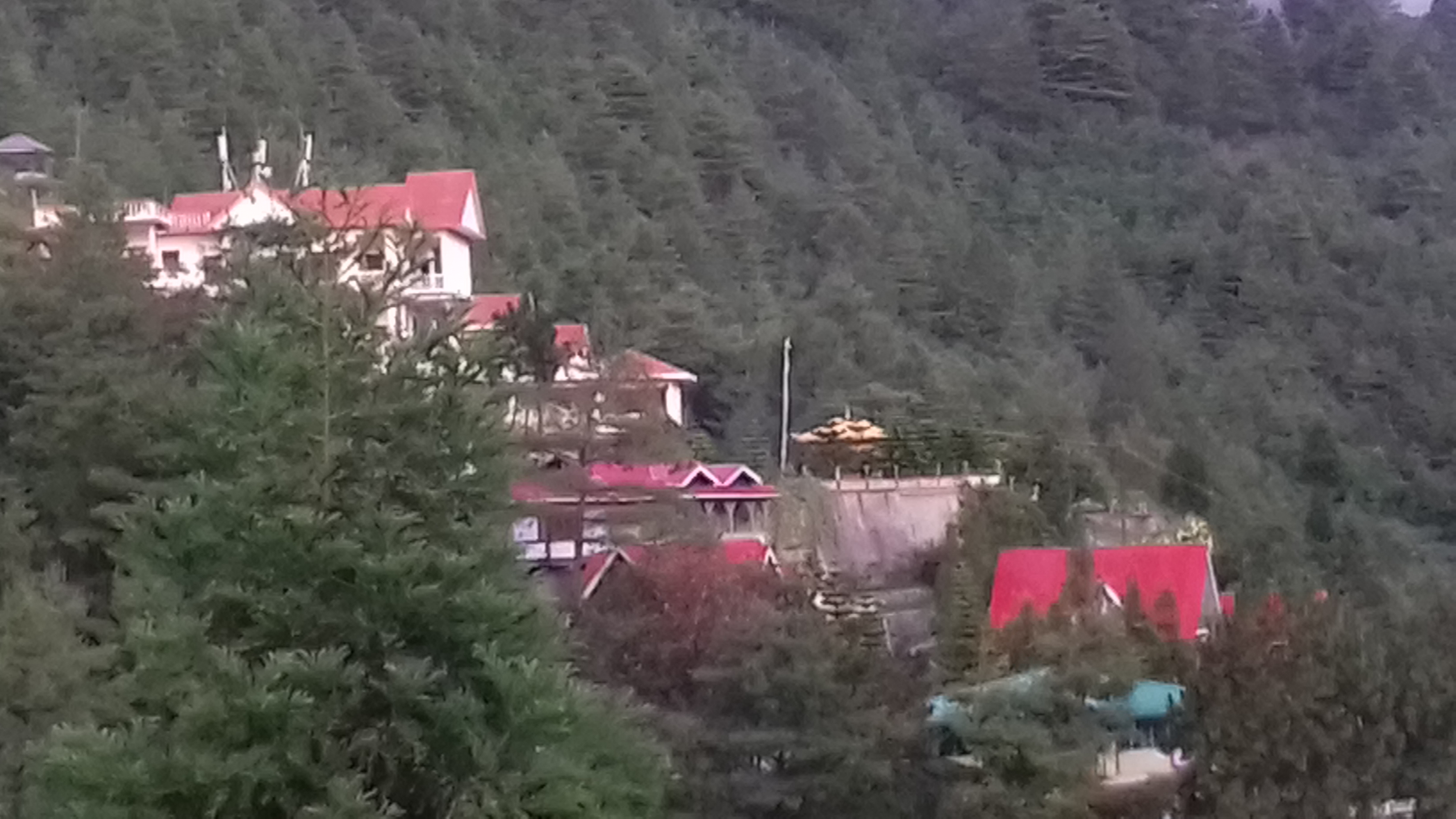
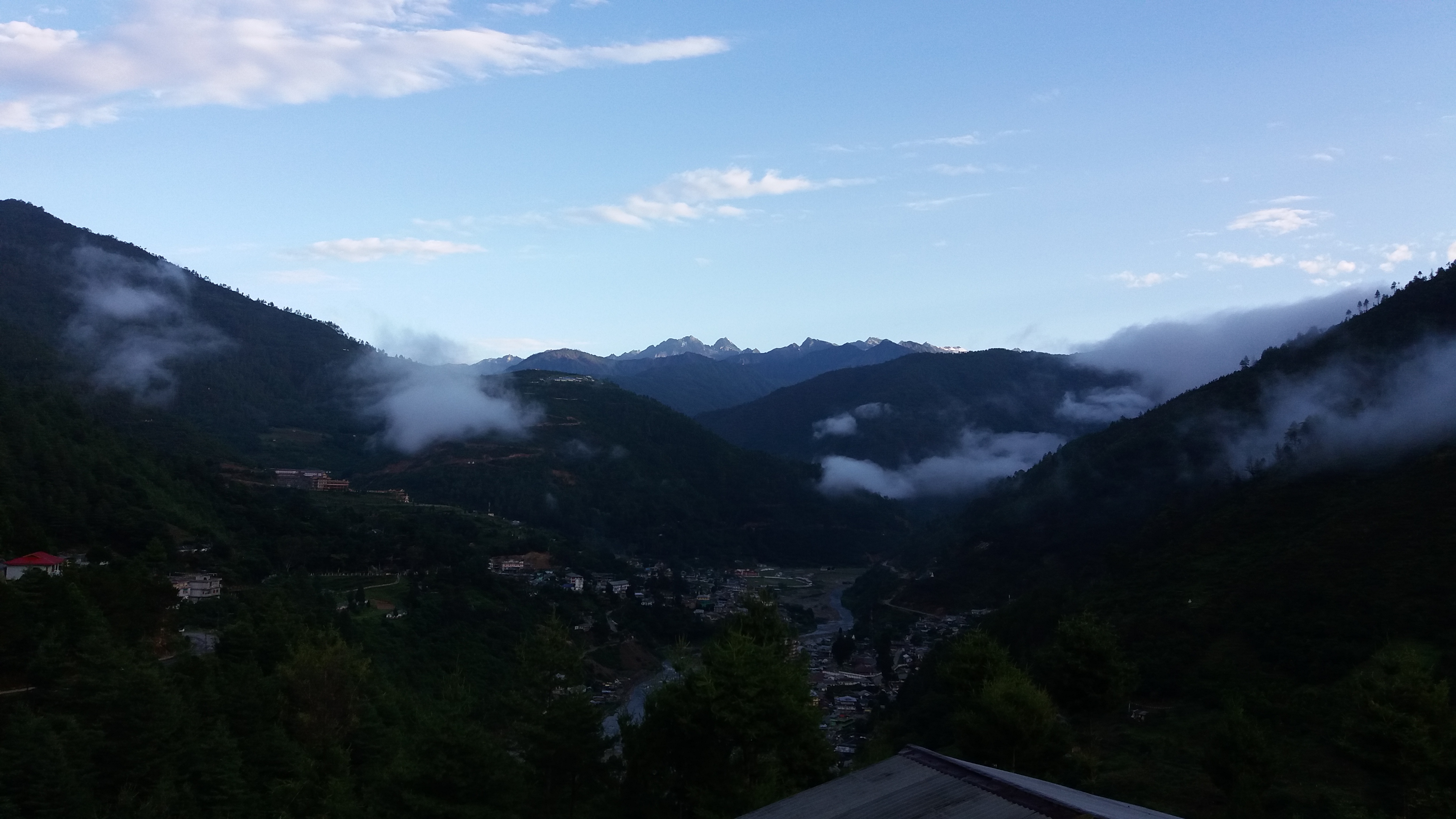
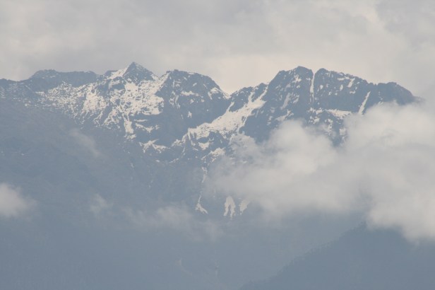
We reached Dirang in the late afternoon and checked into Hotel Pemaling for the night. Dirang, at some 5000 ft, is a hill station of Arunachal. It is famous for its Buddhist monastery as well as for the panoramic view of the valley below. Some snow-clad mountain tops of Tibet are also visible from here. We would halt at Dirang again on our way back. Therefore, there would be no sightseeing on this lap of our journey, said our manager. We walked around the township as much as we could, and then retired for the night.
As at Bhalukpong, here too just as we started our dinner, the manager began his usual briefing for the day ahead. He said that the road from Bhalukpong was but the trailer of the full movie that we were to watch in the day ahead. He spoke about the treacherous road up to and beyond the 13700 ft Se La Pass that we would cross and did not fail to warn that some of us could feel nausea and get a headache at that altitude due to the lack of oxygen in the air. In such an eventuality we were to remain seated in the car and not venture out during the 15-minute halt at the pass. This ominous announcement quite naturally spoilt our appetite for the otherwise wonderful courses prepared by the cook, who accompanied the group all through. No one cared to listen when he said that we would also see a beautiful waterfall at Jang, a few kilometres before Tawang.
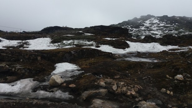
There is not much to say about the road, except that it was indeed worse than the one we had covered so far. Caving-ins at some spots and the bottlenecks created due to the restoration work made it even more difficult. We also saw many more military convoys on this stretch than we had the previous day. The weather worsened as we approached the Se La Pass, and when we reached there, we were enveloped by a thick fog. Though it was drizzling, we did not feel much cold even at that height.


At the Se La pass
Some of us ventured out and walked down to the edge of the lake, which was not visible except when the veil of mist lifted a bit to give us a glimpse. Some snow was visible on the roadside, but none was on the road. I tried to take a few snaps of whatever was visible. None of us had any problem with the thin atmosphere. From Se La to Tawang, the road was somewhat better.
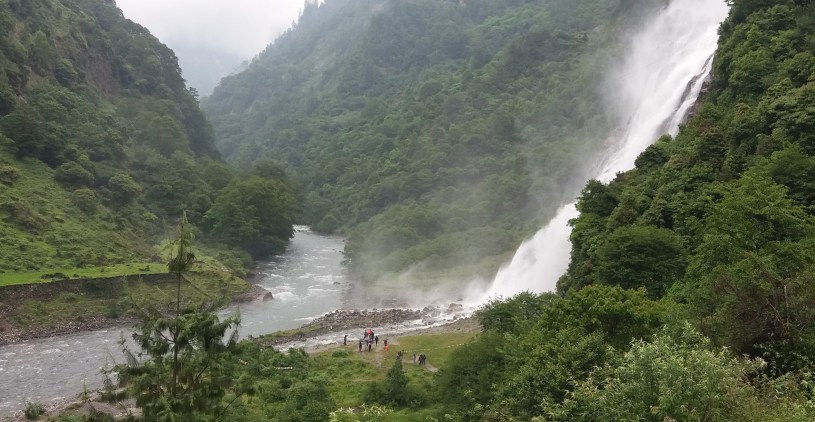
The Nuranang Waterfall, also known as the Jang waterfall, about which our manager had spoken the previous evening, turned out to be a beauty. The gushing water from a height of 100 metres was hitting some huge protruding rocks and this produced a mist. I can hardly describe the beauty of this waterfall set amidst thick forests and a gorge through which passes the Tawang River into which merged the waters from the fall. Our entire group descended the steps to enjoy the sight. A small power plant at the base of the fall caters to the local need for electricity. We reached our hotel at Tawang by teatime.


As usual, our manager began his usual harangue soon after the dinner was served. By then we learnt to live with his scary prognoses about the possible road and weather conditions during the next leg of our journey. Tawang was our final halt; but the trip would remain incomplete without visiting Bum La, a Pass at 15,200 ft where our soldiers are guarding the border with China. The place remains snowbound almost throughout the year. In the later part of May we had some freezing rain.
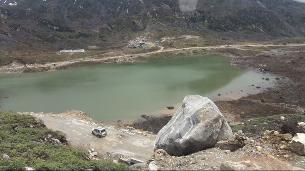
An added attraction is a picnic by the Sangestar Lake, popularly known as the Madhuri Lake after the famous Bollywood actor who had shot a film there. This part of our journey was supposed to have been optional at some additional cost, but eventually we all ‘opted’ for it.
At exactly 8 in the morning when we started our journey to Bum La, which was only 35 km away. That this ‘only’ was just a way of saying, we soon knew the hard way. Initially, the road was good, and we thought it would be like that throughout! But after a few kilometres, the road vanished. All that remained was a track marked by the passage of military trucks which, during winter, have chains on their tyres. Before we ventured on this portion of the drive to Bum La, there was a checking of our special permits. The general upkeep of the vehicles was also perhaps checked, as it seemed from the way the army men were looking at the tyres of our vehicles.
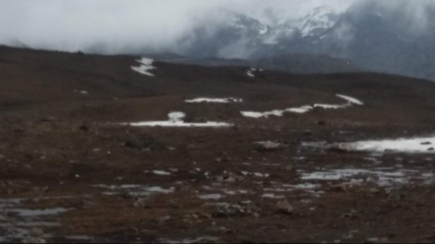
It was the month of May. So, the snow on the hills and the ‘road’ was melting, which created a deadly mess for the vehicles. That is why for this journey we had to hire local drivers and four-wheel drive vehicles. Our Innovas were no good beyond Tamang. As we drove upwards, the dense greenery of pine and other trees that grow at high altitudes gave way to just grass growing on the hillsides where yaks were grazing. Soon even this also vanished, and we were above the tree line and in the land of lofty mountains and snow.

Engineers and men of the Border Roads Organisation were busy ‘maintaining’ the track (road, if you will) primarily for the movement of the heavy trucks of the Army plying throughout the day carrying men and material to and from the frontier. From our cars, we could see heavy guns being towed by trucks. There also were concrete bunkers on both sides of the road. Photography was a strict no in this area, and we stuck to the rules.

As we reached Bum La, we passed an arch with a big “welcome” board. It had started drizzling on the way, and now that turned into what we had learnt in Canada as ‘freezing rain’. Chilled to the bones by the strong wind that was blowing, we filed into a large hall under the careful watch of the Indian army. The trip to the border – some 200 metres away – would be guided, and in groups. There were many tourists here besides our group. The hall was warm and the army provided us with hot water and tea. There also was a desk selling some souvenirs. Our wait was short, and soon we started walking towards the China border, led by a jovial army man.
There is nothing romantic about this, or any other border – at least those I have visited. Here we saw a plateau on which there were hills, high and low. There was snow all around, but the layer had thinned. Our Army guide told us that by September/October snow would fall fast and thick, and the whole place would turn into a white desert. At the border, there was a “Thank You” board in Hindi, Chinese and English. There were a couple of tin-roofed office buildings on one side where the tri-colour was flying. These were for holding border meetings with the Chinese from time to time. There was no sign of the latter, though. Nevertheless, some of the over-enthusiastic tourists who merrily crossed the post were called back and sternly told not to click photographs on the Chinese side. While we did not see them, our guide told us, we were being watched.
Our army is present there right up to the border, the Chinese, we learnt were in their camp some 20 km from here. Their side of the plateau has an all-weather road capable of ferrying their troops in 40 minutes flat, if necessary. On our side of the border, the mountain was brittle and prone to landslides. Hence, the men of the Border Roads Organisation must be on their toes throughout the year to keep the road navigable.
Returning to the welcome hall we had another cup of tea before starting our journey back to Tawang. The packed lunch was to be eaten at the Madhuri Lake. Unfortunately, one of the tourists in our vehicle started feeling unwell. We learnt he suffered from high blood pressure worsened by the height of Bum La. He did not want to visit the lake and would like to go to the hotel for a rest. The two of us had no option but to call off our fixture with the film star and return to Tawang.
But we could not return immediately. The Army had closed the road at one spot. We learnt that the firing drill was on and we could move only when it ended. That could be an hour or more, said the sentry. We were not allowed to leave the vehicle. The place was desolate and silent, with snow here and there. The silence was only pierced by the booms of guns that were being fired. We saw the guns when we came up. Now we were also hearing them roar!

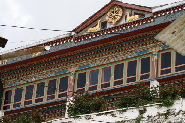
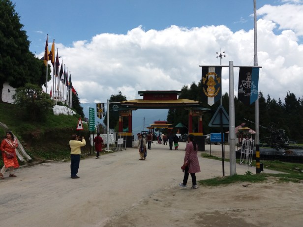
We were to spend that night and the next at Tawang – enough to see the monastery and the town. The formal name of this beautiful monastery – claimed to be the second largest after Potala – is Galden Namgey Lhatse. This beautiful three-storeyed edifice stands on a very large area surrounded by high walls. Besides the main temple, it has residence for the lamas, and a large museum and library. Located on the highest point of Tawang, the monastery is visible from all parts of the town. Built about 400 years ago during the time of the 5th Dalai Lama, this monastery, we learnt, played host to the 14th Dalai Lama when he left Lhasa in March 1959 to avoid capture by the Chinese and, after an arduous trek through lofty mountain passes, crossed into India near Tawang. The view of the city of Tawang from the monastery is breathtaking.


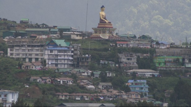
The other ‘must see’ spot in Tawang is the very big statue of Lord Buddha – the Patron Saint of Tawang. The Buddha here is sitting in his usual padmasana on a high pedestal, blessing mankind and especially the city of Tawang.
In between visiting the monasteries, we also visited the war museum, depicting some aspects of the 1962 war with China. But to all of us more attractive was the Army Canteen – not for the food – but for the various items being sold which even civilians could buy. Some of us lapped up whatever was available.

Tawang is also the birthplace of Tsangyang Gyatso, the 6th Dalai Lama (1683). We paid a visit to the house where he was born. Located in a rather secluded part of the town, it is a very peaceful place – ideal for meditation.
Returning to the hotel after the morning sightseeing, my wife and I went around the nearby market. It is a busy place with many shops selling Chinese pottery and other items. They also sell good quality incense sticks and shawls made from yak wool that are worth a look at.
We skipped the lunch provided by the tour company (somewhat fed up eating extremely delicious but utterly Bengali food for every meal) and visited a local restaurant to try some Arunachal specialities. Our host, a very nice lady with a soft manner, suggested we ate a dish each of Churpa with boiled rice. Churpa is a kind of curry made of fermented cheese made from yak milk, into which they put lots of vegetables and meat. As we were not keen on the meat, chicken meat was used as a substitute. The dishes were prepared and served hot. It was wonderful.
Like most tourist places, Tawang also has a light and sound show. We spent the evening enjoying the short but informative presentation about local history and the 1962 war.
Our Arunachal trip was virtually over, but we were to return by the same route. On the way back to Dirang we visited Jaswant Garh, a memorial set up and maintained by the Army for the valiant Rifleman Jaswant Singh Rawat. A part of the caption says:
“In memory of RFN Jaswant Singh Rawat, MVC assisted by L/Nk Trilok Singh Negi and RFN Gopal Singh Gusain as part of Company 4th Battalion Garhwal Rifles on 17 Nov 1962, volunteered to silence an enemy machine gun that had come close to their defences and was firing accurately at the locality. That very day 4th Garhwal Rifles had beaten back two of the enemy attacks on their location. Jaswant Rawat and Gopal Gusain supported by the covering fire from Trilok Negi heroically closed in within grenade-throwing distance and destroyed the Chinese detachment of five men, seizing the MMG. However, in the process of returning Jaswant Rawat and Trilok Negi were killed whereas Gopal Gusain, though seriously injured, came back with the captured weapon. …”
It was nice to see some of the equipment used by the soldiers in those days. Of these, I was particularly drawn to a field telephone complete with a Morse key attached to it. The location of the Memorial is beautiful and the Army Canteen across the road serves a variety of snacks.

We drove down to Bhalukpong the next day, after a visit to the Tipi Orchid Garden on the way. The shady garden has a wide variety of orchids, but only a few of them were in bloom. It was a hot day, and we were happy to reach the hotel at Bhalukpong to break our journey for the night.
It took us about six hours from Bhalukpong to the Guwahati Railway station, which we reached well in time to board our train. A most memorable trip ended, as we parted after exchanging contacts with our fellow travellers.
Arunachal is a hidden jewel for the discerning tourist. This land of lush green forests, lofty mountains, and deep gorges is somewhat unknown to the hoi polloi, and hence, unlike places like Mussoorie or Nainital, Arunachal’s natural beauty has not been spoilt by senseless construction of hotels and resorts. A few days are not enough to comment on this, but from the little I saw, I found the people quite tourist-friendly. Like in most of our hill areas, here too the females seemed to work much more than men.
Till we visited Tawang and the border, our idea of a ‘difficult life’ was merely theoretical. Seeing the Army at work here was an eye-opener. Despite their tough life, they were all full of smiles and were always eager to extend a helping hand. It is the Army that the local people also look up to in any emergency – be it a landslide or a road accident. We said goodbye to Arunachal, thinking about the officers and men of the Army who stood guard night and day at the inhospitable borders to ensure that the country was safe.
********

a fine piece of writing! informative and splendorous too. the beautiful photographs alongside the relevant paragraphs have made the article still more attractive!
LikeLike